


Gallery-quality prints · Independent artists · Décor to adore


from $ 18


from $ 18


from $ 15


from $ 18
” by Alleycatshirts")

from $ 11


from $ 17


from $ 17
” by ArtHistory, 1967")

from $ 15
” by Alleycatshirts")

from $ 11
” by Alleycatshirts")

from $ 11
” by Alleycatshirts")

from $ 11
” by Alleycatshirts")

from $ 11
” by Alleycatshirts")

from $ 11
” by Alleycatshirts")

from $ 11
” by Alleycatshirts")

from $ 11
” by Alleycatshirts")

from $ 11
” by Alleycatshirts")

from $ 11
” by Alleycatshirts")

from $ 11
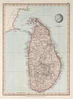
 Vintage Ceylon Island Atl” by Alleycatshirts")
from $ 11
” by Alleycatshirts")

from $ 11
” by Alleycatshirts")

from $ 11
” by Alleycatshirts")

from $ 11
” by Alleycatshirts")

from $ 11
” by Alleycatshirts")

from $ 11
” by Alleycatshirts")

from $ 11
 Vintage Guernsey &” by Alleycatshirts")

from $ 11
” by Alleycatshirts")

from $ 11
” by Alleycatshirts")

from $ 11
” by Alleycatshirts")

from $ 11
” by Alleycatshirts")

from $ 11